photo by Scott Dankof pppppppppp Research at Coldwater Cave

History of Research Activities at Coldwater Cave

Research activities at Coldwater Cave began in 1973 when the state of Iowa appropriated funds to the Iowa Geologic Survey to conduct studies to explore the potential for developing the cave into a state-run 
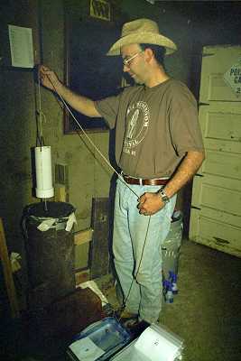
recreational facilitiy. Since the only entrance to the cave was through submerged passages, the state drilled a 94 foot deep, 30-inch diameter shaft and built a wooden platform in the stream to provide access for researchers. Hydrologic parameters were monitored to study pollution levels and detailed records were kept on atmospheric C02 and 02 variations. Because human activity within the cave was minimal, faunal and floral studies were conducted and aimed at establishing a pre-human contact ecological baseline. Research on speleothems, isotopic dates, and climatic interpretations was pursued. A theodolite survey was conducted which documented a little over a mile of cave passage. However, despite the tremendous interest and enthusiasm that the cave generated, the state of Iowa could not justify a large expenditure of money for the projected cost of commercial development. The results of these studies were summarized in a 1974 report from the Iowa Geological Survey entitlted Report on Coldwater Cave: A Summary of Research Results with Inclusion of Information Related to Potential Development of a New Recreational Facility by the State of Iowa, D.L. Koch & S. J. Tuthill.

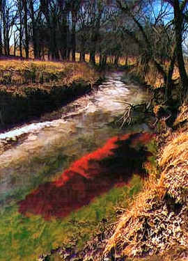
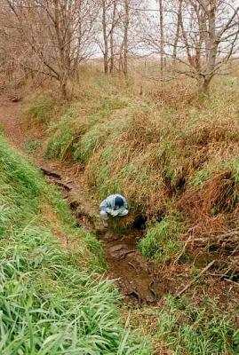
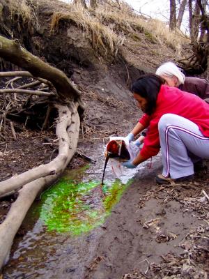
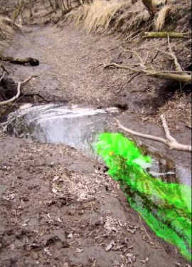
In 1985, Betty Wheeler began groundwater basin studies in the Coldwater Cave area. Her research involved dye tracing to determine the recharge area for the cave, water quality studies and land use analysis. Her results were summarized in two papers which were entitled Agricultural Land Use and Groundwater Quality in the Coldwater Cave Groundwater Basin, Upper Iowa River Karst Region, U.S.A.: Parts I, Huppert, G. N., Wheeler, B. J., Alexander, E. C., Adams, R. S.; Part II Wheeler, B. J., Alexander, E. C, Adams, R. S., Huppert, G. N., 1988, Resource Management in Limestone Landscapes

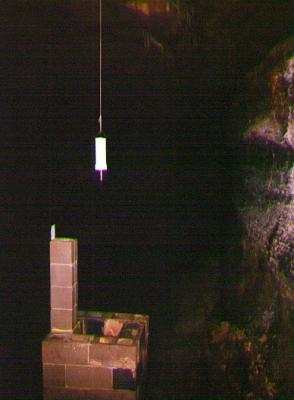
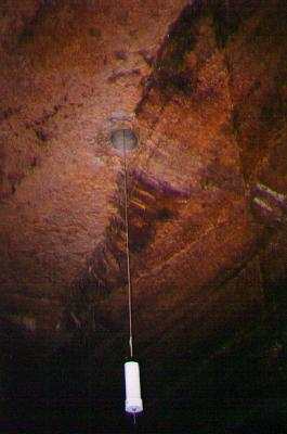
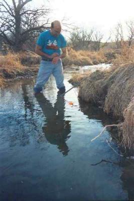
A stream level gauge was installed in a stilling well near the Flatland entrance of the cave in 1980. Mike Bounk oversaw the stream level monitoring from 1980 through 1989 and detailed records were kept of stage level of the cave stream. Preliminary results showed that stream levels were seasonal and responded to precipitation events and snow melts. These results were summarized in an unpublished report titled Stream Water Record in Coldwater Cave, Northeast Iowa, Bounk, M., The stream level records are currently being re-analysed in more detail.

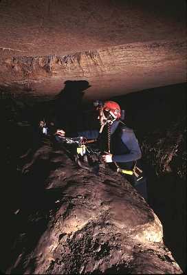
In the early nineties, paleoclimate studies using speleothems from mainstream Coldwater Cave were conducted by Dr. Luis Gonzales and Jeff Dorale of the University of Iowa. Their results are summarized at the following link High Resolution Paleoclimatic Analysis Using Cave Stalagmites"


Research and the Coldwater Cave Project

The Coldwater Project has always supported research. Larry Welch and his students from Knox College have conducted regular water chemistry and atmospheric studies in the system.

The Project provided field support to Bounk's stream level studies and is currently providing assistance in analyzing the stage level data in more detail.

During Betty Wheeler's dye tracing efforts, members of the Coldwater Project provided assistance in collecting both grab samples and dye receptors throughout the study.

Several research projects are currently ongoing at Coldwater Cave. Larry Welch has installed stage recording instrumentation at the stilling well near the Flatland entrance and a weather station in the Coldwater compound to continue the stream/weather monitoring that had been instigated in 1980.

A series of temperature dataloggers have been installed in Coldwater Cave and at some of the springs in order to monitor water temperature variation.(John Lovaas oversees this project.) The loggers record water temperature at 10-minute intervals. So far data has shown that water temperatures from some side passages can vary between 39 and 57 degrees F. This may indicate that those areas of the cave are receiving direct surface drainage i.e. the water has not been underground long enough to equilibrate to "cave" temperature. Other side passages show very minute variations in water temperature indicating that their source of recharge is located a longer distance away thus allowing water temperatures to equilibrate to "cave" temperature.

A hydrologic study of the Coldwater Cave groundwater basin has been in progress since 2001 (Pat Kambesis coordinates this project). The purpose of the study is to delineate the Coldwater Cave groundwater basin, to monitor water quality, and to determine the relationship between landuse and water quality in the study area. So far a total of 10 dye traces have been conducted (with an "official" variance from the State of Iowa). Water quality monitoring has been ongoing for the past 12 months.

Data for a detailed karst hydrologic inventory has been provided from several sources and Coldwater Project members have been adding more GPS locations to the database. Features being inventoried include sinkholes, swallets, sections of loosing stream and springs.

A detailed inventory of locations and descriptions all of the domes that have been discovered to date within the cave has been compiled and efforts are in progress for depicting those features and their attributes on GIS map representations. The domes are an integral part of the hydrologic system that transports surface water underground.

The Coldwater Cave Project has been cooperating with the Upper Iowa River Alliance Project and with the Hoffman Environmental Research Institue (Western Kentucky University) in water quality and contaminant source studies.


photo by Scott Dankof

Samantha Smith, of Knox College(IL), placing some instrumentation in the cave. Her research project observed long term water chemistry changes in different parts of the cave. photo: S. Dankof


Larry Welch installing the weather station at Coldwater Cave. photo: M. Lace


A temperature datalogger in mainstream Coldwater Cave.photo: D. Ryan


Scenes from the hydrologic field study:


photo: P. Kambesis

Mike Nelson doing a recon dive during inventory fieldwork. photo: P. Kambesis
photo: P. Kambesis
Elizabeth Miller at one of the many springs inventoried during the field project. Photo: P. Kambesis


photo by P. Kambesis
Ed Klausner taking pH and conductivity readings at Carolan Spring. photo: P. Kambesis
photo by John Lovaas

Dawn Ryan introducing Rhodamine WT dye into a losing stream in the Coldwater Cave drainage basin. photo: J. Lovaas
photo by John Lovaas
Mike Lace inspecting one of many swallets in the Coldwater Cave groundwater basin. photo: J. Lovaas


photo by P. Kambesis
Hannah Klausner and Elizabeth Miller introducing fluorescein dye into a swallet. photo: P. Kambesis
photo: P. Kambesis
Dye flowing into a swallet. Photo: P. Kambesis
photo by John Lovaas
One of the test shafts drilled by the State serves as an access point for water sampling. photo: J. Lovaas
photo by John Lovaas
Another view of the test shaft from in the cave. photo: J. Lovaas.
photo by Jeff Bushman
John Lovaas retreiving water sample at the surface.photo: J. Bushman
photo by Dawn Ryan
Water flow studies in the cave and in surface streams have revealed much about the quantity of surface water lost into karst conduits. Some stream sections in the area lose over 10,000 gallons per hour in the karst. photo: D. Ryan
photo:  P. Kambesis
Chris Beck collecting a dye receptor at Carolan Spring. photo: P. Kambesis


Home || Coldwater Cave Project || Exploration History || Conservation & Restoration || Cave Documentation || Research || Safety || Photo Gallery || Links
copyright 2003 (C) Coldwater Cave Project